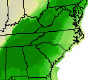
 A flash flood watch is in effect across the region through Tuesday night. Forecasters say rivers and streams are sure to rise in the next few days from the remnants or Tropical Storm Lee. More from WFIR’s Evan Jones.
[audio:http://wfirnews.com/wp-content/uploads/2011/09/09-05-Flood-Threat-Wrap1-WEB.mp3|titles=09-05 Flood Threat Wrap1-WEB]
It’s not that we can’t use some wet weather, but Meteorologist Phillip Manuel at the National Weather Service in Blacksburg says this will be more than we need: 4 to 6 inches or rain likely across the Roanoke Valley. The first rain will be welcome and should soak into the soil, but once the ground gets saturated, that’s when waters will rise. It’s just a matter of how quickly they rise, how high, and whether it could become disruptive.
Click here for the latest National Weather Service information for the Roanoke Valley.


