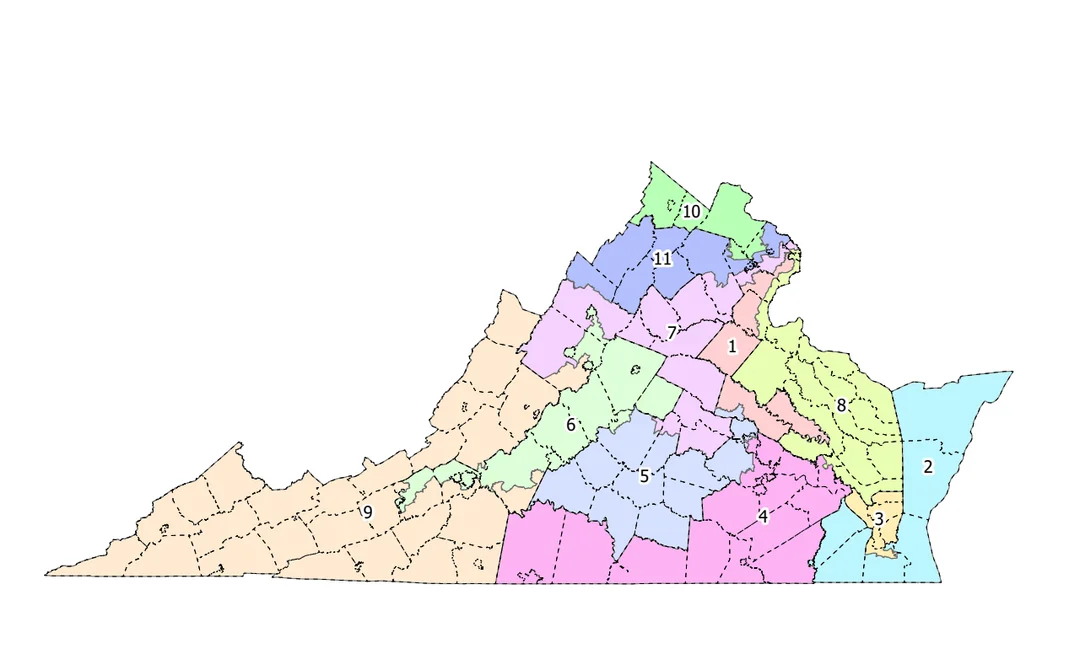
RICHMOND, Va. – Virginia Democrats on Thursday released a proposed congressional map that would fundamentally alter the political makeup of Western Virginia, placing most of Roanoke in a competitive new 6th District while splitting Roanoke County along Interstate 81.
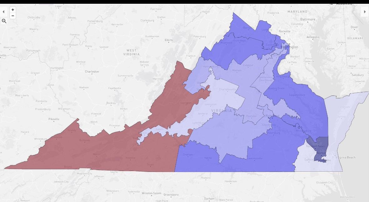
The proposal aims to create a 10-1 Democratic advantage across Virginia’s 11 congressional districts. The move comes amid a contentious legal battle and is framed by Democratic leaders as a necessary counter to Republican-led redistricting efforts in other states.
If enacted, the new map would significantly change representation for the region.
A County Divided: Roanoke Split by Interstate 81
A key local change in the proposal is the division of Roanoke County into two separate congressional districts, using Interstate 81 as the primary dividing line.
Under the plan, all areas of the county north of I-81 would be in the new 6th Congressional District. This includes communities such as Hollins, Cloverdale, and parts of Glenvar. The city of Roanoke would be entirely within the 6th District.
Everything in the county south of I-81 would be drawn into the 9th Congressional District. This includes the populous Cave Spring area and communities along Route 221.
A New, Competitive 6th District
The proposed 6th District would become a politically competitive seat by combining several major urban centers, including Roanoke, Lynchburg, Charlottesville, and Harrisonburg. It would place incumbent Rep. Ben Cline, R-Botetourt, in a much more challenging district.
The map could also force a Democratic primary between prominent candidates. Roanoke author Beth Macy and former Charlottesville-area Rep. Tom Perriello have both said they intend to run.
The 9th District Becomes a GOP Stronghold
The 9th Congressional District, currently held by Rep. Morgan Griffith, R-Salem, would be reshaped to consolidate the most conservative areas of the state. It would stretch from Lee County in the far southwest, east to Martinsville, and north to include southern Roanoke County. This would make it the last safe Republican seat in Virginia.
A Statewide Political Battle
Democratic leaders pitched the map as a direct response to a national push by former President Donald Trump for Republican-led states to redraw their maps ahead of the 2026 midterm elections.
Republicans have denounced the effort as an illegal and partisan power grab. “This is an illegal, hyper-partisan gerrymander drawn in backrooms hidden from the public,” said Mike Young, president of the Republican-led group Virginians for Fair Maps.
An Uncertain Legal Path
The map’s future is uncertain. A Tazewell County judge has already halted the process, ruling it unconstitutional. Democrats have appealed that decision to the Supreme Court of Virginia.
For the map to become law, a constitutional amendment allowing mid-decade redistricting must be approved by voters in a special referendum scheduled for April 21.