


Crime and Public Safety


The National Weather Service has issued a Flash Flood Watch for much of Southside and southwest Virginia that covers three days — starting Sataurday morning and running through Monday evening. The watch area includes Roanoke, Franklin and Montgomery Counties. The weather service says four to eight inches of rain are likely in coming days, and locally higher amounts of 10 inches are possible along the Blue Ridge. The weather service says moderate to perhaps major flooding is possible along rivers that include the New and Roanoke.
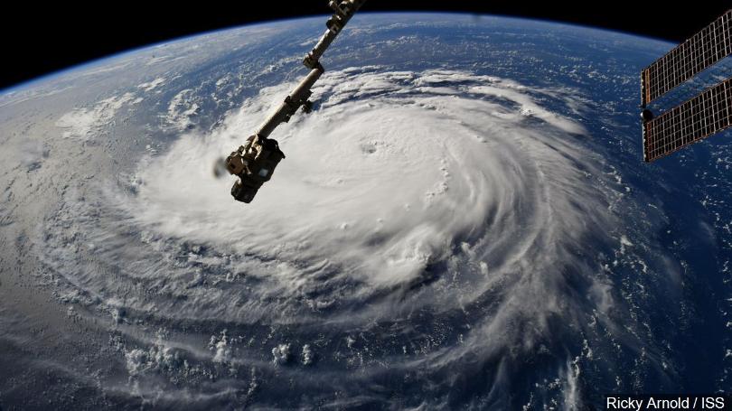
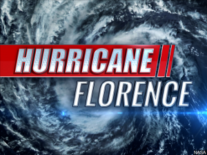
From the National Weather Service: Hurricane Florence will slowly track inland this afternoon and into South Carolina tonight into Saturday, before turning northwest across the southern Appalachians Sunday, and heading into the central Appalachians Monday. With soils saturated or becoming saturated, the threat of flash flooding is likely to develop later this weekend into Monday.
FLASH FLOOD WATCH IN EFFECT FROM SATURDAY MORNING THROUGH MONDAY EVENING
The National Weather Service in Blacksburg has expanded the
* Flash Flood Watch to include portions of south central Virginia, southwest Virginia, and west central Virginia, including the following areas, in south central Virginia, Halifax, Henry, and Pittsylvania. In southwest Virginia, Montgomery, Pulaski, Smyth, and Wythe. In west central Virginia, Franklin and Roanoke.
* From Saturday morning through Monday evening.
* Heavy rain from Florence will lead to flash flooding across the area, especially by Saturday afternoon and evening into Monday. 4 to 8 inches of rain are expected, with locally higher amounts of 10 inches or more possible along the Blue Ridge.
* Life-threatening flash flooding may develop as heavy rain bands occur this weekend into Monday. Streams and creeks may rise quickly during heavy rain and flood.
* As the excessive rainfall occurs across the headwaters of the larger rivers, moderate to perhaps major flooding could occur especially along the New, Roanoke and Dan Rivers Sunday night into early next week.
* Rainfall of more than five inches in similar storms has been associated with an increased risk of landslides and rock slides. If you live in locations closer to the mountains and foothills…especially near a stream…be ready to leave in advance of the storm or as quickly as possible should rising water…moving earth…or rocks threaten. Consider postponing travel along mountain roads during the period of heavy rainfall.
PRECAUTIONARY/PREPAREDNESS ACTIONS…
A Flash Flood Watch means that conditions may develop that lead to flash flooding. Flash flooding is a VERY DANGEROUS SITUATION. Remember…TURN AROUND…DON`T DROWN!
You should monitor later forecasts and be prepared to take action should Flash Flood Warnings be issued.
 Emergency management officials say while Virginia appears all but certain to avoid the worst of Florence, the state is still prepared to respond to any significant flooding that is still possible in southwest regions into early next week. Some response resources are already in place in the southwest, and more can be brought in if needed. WFIR’s Evan Jones has the story.
 Roanoke City Manager Bob Cowell has declared a local state of emergency as Hurricane Florence approaches the U.S. mainland. Cowell says even if forecast impacts here have diminished in recent days, a significant amount of uncertainty and risk remain. The declaration ensures access to outside funding that would help recoup costs of response or recovery efforts that might become necessary.
From the City of Roanoke: Roanoke City Manager Bob Cowell has declared a local state of emergency to exist within the City of Roanoke pursuant to Section 44-146.21(a), Code of Virginia (1950), as amended and in accordance with the City of Roanoke 2016 Emergency Operations Plan. City Council will confirm this action at its next regularly scheduled session on Monday, Sept. 17.
“Though forecasted conditions for our area appear to have improved slightly, there remains a significant amount of uncertainty and risk,” said Mr. Cowell. “Out of an abundance of caution, I have issued a Declaration of a Local Emergency this morning. This action will also help ensure access to outside funding to assist in defraying costs associated with response or recovery from impact of the Hurricane. The Declaration is consistent with the action taken by Governor Northam on Sept. 8, and I believe prudent at this time. I ask the residents of Roanoke to join us in continuing to prepare for a worst-case scenario, while praying for a best-case outcome. Advanced preparations make individuals, families, and our first responders safer.”
To see a list of frequently asked questions regarding preparation for the storm, click on this link. In response to the potential hazardous weather conditions Roanoke may experience from the storm, the following actions are recommended.
Key Safety Messages:
1. Prepare an emergency kit and enough food and water to last for at least 72 hours.
2. Do not attempt to drive in flowing water. #TurnAroundDontDrown
3. If you require special health or medical accommodations in Emergency Situations and power outages, please fill out the confidential Emergency Needs Registry form.
4. For immediate updates, please enter your phone number into Emergency Management’s Reverse 9-1-1 Citizen Phone Alert system.
5. To report a power outage, please contact Appalachian Power at 1-800-956-4237.
6. To report a water or sewage emergency, please contact the Western Virginia Water Authority at 540-853-5700.
7. Calls or texts to 911 should be reserved for medical, fire, or police emergency situations only.
 UPDATE: The modified lockdown has been lifted.
Roanoke County school officials say Cave Spring High School was placed on a “modified lockdown” this morning. That means classes are being conducted on normal schedules, but access to the school is restricted. Spokesperson Chuck Lionberger says the step was taken in response to “an unconfirmed report of a threatening rumor on social media”.
 While some may argue that the school dismissals and event postponements in anticipation of Hurricane Florence were done prematurely — a state official would disagree. WFIR’s Ian Price has more:
Sen. Tim Kaine
Virginia’s junior US Senator joined us live on-air this morning after speaking with Governor Northam and FEMA officials in Washington as Hurricane Florence approaches landfall. More from WFIR’s Gene Marrano:
Hear our extended conversation with Senator Tim Kaine below:
 Health care systems with a major presence in the region are also part of emergency preparedness plans with Hurricane Florence forecast to have some type of impact locally over the next few days. More from WFIR’s Gene Marrano: